")
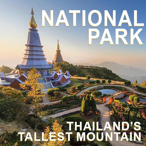
Kew Mae Pan Nature Trail is a must-do hiking and trekking trail not to be missed by nature lovers. It is located inside the area of Doi Inthanon National Park, home to Thailand’s highest peak.
Visitors to the National Park should include visiting this trail on their itinerary because the reward of hiking this short distance (2.78km) natural walk could be the most beautiful panoramic view you will ever see in Thailand.
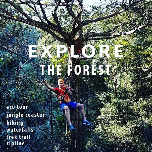
This green highly-rated trail takes about 2-3 hours to finished and suitable for beginner level hikers. However, it is not recommended for people who cannot climb stairs because some trail parts require uphill hiking.

Sunrise at Kew Mae Pan Viewpoint
The trail sits at 2,200 meters above sea level, just a few hundred meters below Thailand’s highest peak (2,565 meters). Take note that Doi Inthanon National Park is opened all year but Kew Mae Pan Nature Trail is closed from June to October i.e. the raining season.
The trail does not charge an entrance fee (already covered by the National Park entrance fee) but due to the delicate thick forest, it is compulsory to hire a guide, which is the local Hmong hill tribe people who are highly expert on the route but speak very little English.
The guide fee is only 200 baht for a group of visitors (not more than 10 people). At the starting point, you will be given a bamboo hiking stick, which the guide call them the “wooden support”.

Kew Mae Pan Circular Trail Map
Kew Mae Pan is a circular hiking trail, meaning visitors will go all the way right back to the starting point led by the Hmong guide. The walking trail can be divided into 3 stages, consists of a total of 21 stations. At each station, there is an interpretive sign in Thai and English language explaining different landscape and ecosystems of the trail.
The first stage is a dense cloud forest walking trail (station 1 – 6) full of moss and ferns. The evergreen forest is a watershed area because of its key role in trapping moisture in the cloud. One can hike slowly enjoying the cold fresh oxygen from thin air.
Trees are high but not thick, struggling to get light while the cloud regularly hits the mountain and soaks the whole forest with high moisture. Mae Pan Waterfall is at station 3.

Mae Pan Waterfall
The second stage (station 7 – 14) is a walk through the scenic open grassland whose bright sunshine is warmer than a walk in the forest. This wide area changes colour from green in raining season to beautiful golden brown during the dry season.
Station 9 is the panoramic viewpoint to take “that” breathtaking mountain view shot and where early risers waiting for the beautiful sunrise.

The Viewpoint at Kew Mae Pan


The Sea of Cloud from the Viewpoint

The Ridge at Station 12
Between station 14 and 15 is the point where the King and Queen chedis i.e The Pra Mahathart Napamaythaneedol Chedi and the Pra Mahathart Napapoommisiri Chedi can be seen.

The King and Queen Chedi from Station 15
From station 15 is the last stage where we are back into the forest again. The temperature in the forest is a few degrees lower than outside and it could fell to as low as 0°C during winter time (December – February).
Near the end of the trail, there is a podium at station 20 for visitors to rest while enjoying the sounds of nature. You can hear the sound of the wind and birds singing like a band and lapping water sounds.

The Forest Walking Trail
How To Get To Kew Mae Pan Nature Trail
Kew Mae Pan Natural Trail is located inside the area of Doi Inthanon National Park, read here about How To Get To Doi Inthanon. Some tour operator arranging day-trip to the National Park will include Kew Mae Pan on their itinerary. Please ask them before booking because not everyone visiting the Park wants to spend a few hours hiking.
When you are doing the Mae Hong Son Loop road-trip, you may want to slot this hiking trip into your schedule. Read The Mae Hong Son Loop Road-Trip Complete Guide 2019.
If you are coming from downtown Chiang Mai by car or motorbike, follow google map to the point 18.55555 98.48235.
The trail entrance is located in a huge car park area, which is about 500 meters past the entrance to the twin chedis. You will see this big signage as soon as you turn into the car park area.

What To Bring When Visiting

Kew Mae Pan is opened from 6.00am to 4.00pm.
What Time To Visit


 – Beautiful Tranquil Village in Mae Hong Son, Northern Thailand")

 – The Most Romantic Destination in Thailand")